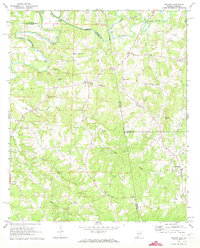
1969 Map of Graham
USGS Topo · Published 1973About this map
Graham and its surrounding rural communities sit along the undulating state line dividing Alabama and Georgia during the late 1960s. This survey records a landscape defined by small-scale agriculture and a dense network of country churches, including Bethlehem-Camp Ground Ch and St James Ch. The Little Tallapoosa River meanders through the northern section, crossed by local landmarks like Mucklee Bridge and Thompson Bridge. Further south, the terrain rises toward Blackjack Mtn near the community of Ephesus. The map is particularly useful for genealogists, as it identifies numerous small family and community burial sites such as Buchanan Memorial Cem and the Old Shiloh Church Cem. The distribution of these landmarks, alongside named branches like Tanyard Branch and Knight Branch, illustrates the persistent settlement patterns of Randolph County and Cleburne County prior to modern suburbanization.
Find a feature on this map
38 named features on this map. Tap any name to fly to it.
Don’t see what you’re looking for? This feature index may not catch every label — zoom into the map to look around manually.
Map Details
Editions of this 1969 Graham Map
3 editions found
Other maps of this area

1889 · Tallapoosa
USGS Topo · 1:125,000

1892 · Tallapoosa
USGS Topo · 1:125,000

1897 · Tallapoosa
USGS Topo · 1:125,000

1899 · Wedowee
USGS Topo · 1:125,000

1902 · Wedowee
USGS Topo · 1:125,000

1953 · Atlanta
USGS Topo · 1:250,000

1957 · Atlanta
USGS Topo · 1:250,000

1958 · Atlanta
USGS Topo · 1:250,000

1958 · Carrollton
USGS Topo · 1:62,500

1964 · Roopville
USGS Topo · 1:24,000