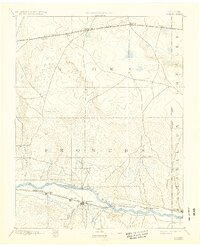
1894 Map of Granada
USGS Topo · Published 1932About this map
The Arkansas River valley serves as the primary corridor for settlement and commerce in this late 19th-century survey of the high plains. Two major rail lines dominate the landscape, with the Atchison Topeka & Santa Fe Railroad paralleling the river through the southern portion of the sheet, and the Missouri Pacific Railroad cutting across the northern reaches near Sheridan Lake. The map captures a moment of early agricultural and ranching expansion, noted by landmarks like Ellis Ranch and Watsons Ranch, as well as emerging rail stops such as Granada and Hollys. Numerous ephemeral waterways, including Big Sandy Creek and Two Butte Creek, drain the vast prairie toward the Arkansas, revealing the drainage patterns that dictated the placement of early settlements and livestock operations in the region.
Find a feature on this map
31 named features on this map. Tap any name to fly to it.
Don’t see what you’re looking for? This feature index may not catch every label — zoom into the map to look around manually.
Map Details
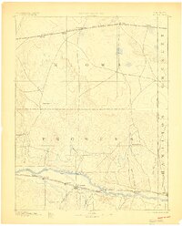
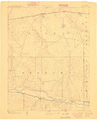
Editions of this 1894 Granada Map
4 editions found

Other maps of this area

1890 · Granada
USGS Topo · 1:125,000

1891 · Albany
USGS Topo · 1:125,000

1891 · Kit Carson
USGS Topo · 1:125,000

1892 · Lamar
USGS Topo · 1:125,000

1892 · Cheyenne Wells
USGS Topo · 1:125,000

1892 · Granada
USGS Topo · 1:125,000

1892 · Two Butte
USGS Topo · 1:125,000

1893 · Kit Carson
USGS Topo · 1:125,000

1893 · Two Butte
USGS Topo · 1:125,000

1893 · Albany
USGS Topo · 1:125,000