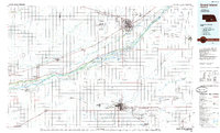
1985 Map of Grand Island
USGS Topo · Published 1985About this map
Grand Island and Hastings anchor this mid-1980s portrait of the Platte River valley, where the landscape is defined by the braided channels of the Platte River and its intricate distributaries like the North Channel Platte River and Mormon Island River. The map reveals a region deeply tied to mid-century industrial and military history, dominated by the massive footprints of the Cornhusker Ordnance Plant north of Alda and the US Ammunition Depot (Abandoned) east of Hastings. These facilities, alongside the Army National Guard Training Site, underscore the area's strategic importance during and after the war years. Transportation patterns are clearly etched by the Union Pacific and Burlington Northern railroads, which parallel the river's course and link smaller agricultural settlements such as Juniata, Kenesaw, and Doniphan.
Find a feature on this map
101 named features on this map. Tap any name to fly to it.
Don’t see what you’re looking for? This feature index may not catch every label — zoom into the map to look around manually.
Map Details
Editions of this 1985 Grand Island Map
2 editions found
Other maps of this area

1892 · Grand Island
USGS Topo · 1:62,500

1894 · Kenesaw
USGS Topo · 1:62,500

1894 · Kearney
USGS Topo · 1:62,500

1894 · Minden
USGS Topo · 1:62,500

1895 · Grand Island
USGS Topo · 1:62,500

1895 · Wood River
USGS Topo · 1:62,500

1896 · Holdrege
USGS Topo · 1:125,000

1896 · Kearney
USGS Topo · 1:125,000

1896 · Wood River
USGS Topo · 1:125,000

1896 · Stromsburg
USGS Topo · 1:125,000