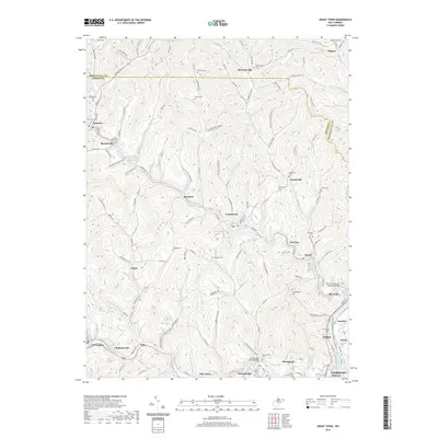
2019 Map of Grant Town
USGS Topo · Published 2019About this map
Grant Town and the Paw Paw Creek valley are the centerpiece of this northern West Virginia survey, where the winding watercourses of Marion Co and Monongalia Co dictate the local geography. The landscape is defined by its deep drainages, including Little Paw Paw Cr, Indian Cr, and Pharaoh Run, which carved the hollows that historically hosted small farming and coal-mining communities. Genealogists will find a high density of family-named cemeteries, such as Wilson Cem, Hagans Cem, and the Barrackville Cem, which preserve the heritage of these hollows. A significant architectural landmark, the Barrackville Covered Bridge, stands near Buffalo Creek, reflecting the early transportation history of the region. The map also traces modern connections like the Paw Paw Veterans Memorial Bridge near Rivesville and the Monongahela River Water Trail (Water), illustrating how these riverfront settlements have transitioned while maintaining their connection to the water.
Find a feature on this map
142 named features on this map. Tap any name to fly to it.
Don’t see what you’re looking for? This feature index may not catch every label — zoom into the map to look around manually.
Map Details
Editions of this 2019 Grant Town Map
This is the sole edition of this map. No revisions or reprints were ever made.
Other maps of this area

1902 · Clarksburg
USGS Topo · 1:62,500

1902 · Fairmont
USGS Topo · 1:62,500

1904 · Blacksville
USGS Topo · 1:62,500

1905 · Mannington
USGS Topo · 1:62,500

1910 · Clarksburg
USGS Topo · 1:62,500

1923 · Blacksville
USGS Topo · 1:62,500

1923 · Fairmont
USGS Topo · 1:62,500

1923 · Mannington
USGS Topo · 1:62,500

1923 · Clarksburg
USGS Topo · 1:62,500

1925 · Blacksville
USGS Topo · 1:62,500