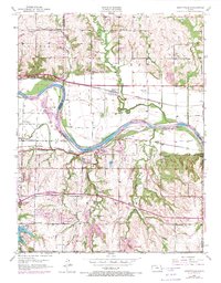
1950 Map of Grantville
USGS Topo · Published 1971About this map
The Kansas River flows eastward across this 1950 survey, which was updated in 1970 to reflect the growth of suburban infrastructure and the expansion of recreation areas like Lake Shawnee County Park. The landscape is defined by its historic transit corridors, where the Union Pacific and Atchison Topeka and Santa Fe railroads parallel the river valley. The map documents a transition from rural school districts to more centralized developments, marking the locations of rural landmarks like Fairview Sch, Millikin Sch, and the Oak Grove Sch (Abandoned). Near the river bend, Franks Island sits between the main channel and the north bank, while the small settlements of Grantville and Tecumseh anchor the local community. The presence of Radio Station WREN and Radio Station KEWI points to the area's role as a regional communications hub during the mid-20th century.
Find a feature on this map
38 named features on this map. Tap any name to fly to it.
Don’t see what you’re looking for? This feature index may not catch every label — zoom into the map to look around manually.
Map Details
Editions of this 1950 Grantville Map
4 editions found

Other maps of this area

1885 · Lawrence
USGS Topo · 1:125,000

1886 · Oskaloosa
USGS Topo · 1:125,000

1888 · Oskaloosa
USGS Topo · 1:125,000

1889 · Burlingame
USGS Topo · 1:125,000

1889 · Topeka
USGS Topo · 1:125,000

1889 · Lawrence
USGS Topo · 1:125,000

1894 · Burlingame
USGS Topo · 1:125,000

1894 · Oskaloosa
USGS Topo · 1:125,000

1894 · Topeka
USGS Topo · 1:125,000

1947 · Lawrence
USGS Topo · 1:250,000