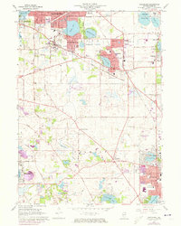
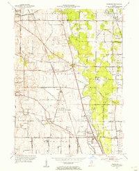
1960 Map of Grayslake
USGS Topo · Published 1973About this map
Grayslake and its neighboring lakefront communities sit at a moment of significant transition in this mid-century survey, with purple-tinted urban extensions marking the rapid post-war growth of Round Lake Beach and Mundelein. The landscape is defined by its glacial hydrology, from the large waters of Third Lake and Gages Lake in the north to the southern reaches of Diamond Lake and Countryside Lake. Transport and recreation networks are deeply integrated into the suburban fabric, evidenced by the Chicago Milwaukee St Paul and Pacific rail line and numerous leisure sites like the Brae Loch Country Club and a local Drive-in Theater. Scattered among these newer developments are the older rural foundations of Lake County, including Fremont Center, the historic Avon-Centre Cem, and several parochial institutions like Santa Maria Sch and St Gilberts Sch.
Find a feature on this map
68 named features on this map. Tap any name to fly to it.
Don’t see what you’re looking for? This feature index may not catch every label — zoom into the map to look around manually.
Map Details
Editions of this 1960 Grayslake Map
4 editions found
Other maps of this area

1900 · Highwood
USGS Topo · 1:62,500

1906 · Waukegan
USGS Topo · 1:62,500

1908 · Waukegan
USGS Topo · 1:62,500

1920 · Grays Lake
USGS Topo · 1:62,500

1923 · Grays Lake
USGS Topo · 1:62,500

1923 · Barrington
USGS Topo · 1:62,500

1928 · Wheeling
USGS Topo · 1:24,000

1935 · Barrington
USGS Topo · 1:62,500
1953 · Wheeling
USGS Topo · 1:24,000

1954 · Rockford
USGS Topo · 1:250,000