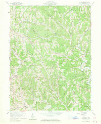
1960 Map of Graysville
USGS Topo · Published 1970About this map
Wayne National Forest covers much of this Monroe County landscape, where deep hollows and narrow ridges dictated the placement of pioneer roads and early family farms. In the south, an Indian Mound near Lamping Cem serves as a reminder of much older inhabitants, while more recent nineteenth-century history is preserved at the Covered Bridge in Sycamore Valley. The settlement at Graysville functions as a local hub, supported by a network of smaller communities like Hartshorn, Sprague, and Marr. Dozens of oil and gas wells are scattered across the terrain, notably along Clover Ridge and Hartshorn Ridge, illustrating the region's extraction-based economy. Local life centers on rural institutions such as the Grange Hall and Wayne Sch, with family history traceable through numerous remote burying grounds including Henthorn Cem, Knowlton Cem, and McVay Cem.
Find a feature on this map
85 named features on this map. Tap any name to fly to it.
Don’t see what you’re looking for? This feature index may not catch every label — zoom into the map to look around manually.
Map Details
Editions of this 1960 Graysville Map
4 editions found
Other maps of this area

1903 · Macksburg
USGS Topo · 1:62,500

1905 · New Matamoras
USGS Topo · 1:62,500

1905 · Woodsfield
USGS Topo · 1:62,500

1905 · Macksburg
USGS Topo · 1:62,500

1909 · Summerfield
USGS Topo · 1:62,500

1911 · Summerfield
USGS Topo · 1:62,500

1924 · New Matamoras
USGS Topo · 1:62,500

1926 · New Matamoras
USGS Topo · 1:62,500

1949 · Clarksburg
USGS Topo · 1:250,000

1956 · Clarksburg
USGS Topo · 1:250,000