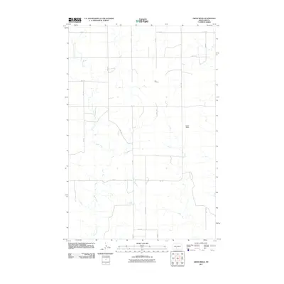
2011 Map of Green Ridge
USGS Topo · Published 2011About this map
Beaver Creek winds through this rural section of Morton County, following the natural contours of the northern Great Plains. The landscape is defined by the prominent Green Ridge, a topographic feature that lends its name to this specific quadrangle. This 2011 survey captures the area's transition into the 21st century while maintaining its grid-based agricultural identity. The presence of Zion Cemetery near the center of the sheet serves as a primary point of interest for genealogists tracing family roots in this sparsely populated region. A network of numbered roads, including 49th St and County Rd 84, provides a structured view of the land divisions and farm access points that have shaped the local economy for decades.
Find a feature on this map
16 named features on this map. Tap any name to fly to it.
Don’t see what you’re looking for? This feature index may not catch every label — zoom into the map to look around manually.
Map Details
Editions of this 2011 Green Ridge Map
This is the sole edition of this map. No revisions or reprints were ever made.
Other maps of this area

1954 · Bismarck
USGS Topo · 1:250,000

1958 · Bismarck
USGS Topo · 1:250,000

1960 · New Salem
USGS Topo · 1:24,000

1970 · Judson
USGS Topo · 1:24,000

1972 · Sweet Briar
USGS Topo · 1:24,000

1980 · Otter Creek West
USGS Topo · 1:24,000

1980 · Green Ridge
USGS Topo · 1:24,000

1980 · Otter Creek East
USGS Topo · 1:24,000

1980 · Almont East
USGS Topo · 1:24,000
1980 · Fish Creek Lake
USGS Topo · 1:24,000