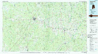
1986 Map of Greenville
USGS Topo · Published 1986About this map
Greenville and the surrounding South Central Alabama landscape are defined here by a dense network of creek systems and small agricultural communities in the mid-1980s. The terrain transitions between the Patsaliga Creek and Pigeon Creek basins, where timber and land management are prominent, evidenced by the large Butler County State Wildlife Management Area. Local infrastructure is anchored by the Seaboard System and Southern Railway lines, which historically drove the development of towns like Georgiana, Luverne, and McKenzie.
Find a feature on this map
177 named features on this map. Tap any name to fly to it.
Don’t see what you’re looking for? This feature index may not catch every label — zoom into the map to look around manually.
Map Details
Editions of this 1986 Greenville Map
2 editions found
Other maps of this area

1942 · Enterprise
USGS Topo · 1:125,000

1948 · Brundidge
USGS Topo · 1:62,500

1950 · Enterprise
USGS Topo · 1:62,500

1950 · Brundidge
USGS Topo · 1:62,500

1953 · Montgomery
USGS Topo · 1:250,000

1953 · Andalusia
USGS Topo · 1:250,000

1953 · Dothan
USGS Topo · 1:250,000

1954 · Dothan
USGS Topo · 1:250,000

1955 · Dothan
USGS Topo · 1:250,000

1955 · Phenix City
USGS Topo · 1:250,000