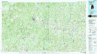
1986 Map of Greenville
USGS Topo · Published 1989About this map
Greenville and Georgiana anchor the heart of this mid-1980s South Alabama corridor, where the Seaboard System Rr defines the movement of goods and people through Butler Co. The landscape transitions from the developed hubs of Luverne and Troy into the dense timber and wetlands of the Butler County State Wildlife Management Area. To the west, the winding Sepulga River and Patsaliga Creek drain a terrain marked by distinctive high points like Barganier Hill and the Sepulga Lookout.
Find a feature on this map
163 named features on this map. Tap any name to fly to it.
Don’t see what you’re looking for? This feature index may not catch every label — zoom into the map to look around manually.
Map Details
Editions of this 1986 Greenville Map
2 editions found
Other maps of this area

1942 · Enterprise
USGS Topo · 1:125,000

1948 · Brundidge
USGS Topo · 1:62,500

1950 · Enterprise
USGS Topo · 1:62,500

1950 · Brundidge
USGS Topo · 1:62,500

1953 · Montgomery
USGS Topo · 1:250,000

1953 · Andalusia
USGS Topo · 1:250,000

1953 · Dothan
USGS Topo · 1:250,000

1954 · Dothan
USGS Topo · 1:250,000

1955 · Dothan
USGS Topo · 1:250,000

1955 · Phenix City
USGS Topo · 1:250,000