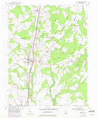
1955 Map of Greenwood
USGS Topo · Published 1982About this map
Greenwood serves as a central hub on this Sussex County survey, situated where the Conrail line parallels the prominent Dupont Parkway. The landscape is defined by the headwaters of the Nanticoke River and a dense network of branches including Toms Branch and Marsh White Branch. A mix of agricultural clearings and managed timberland is evident, particularly within the Owens State Forest and the intriguingly named Devils Woodyard. Small rural settlements like Farmington, Staytonville, and Woodyard dot the crossing points of the local road system. Genealogists will find significant value in the distribution of country churches and local landmarks, such as St Johnstown Ch and Tressler Ch, which reflect the community structure of central Delaware during the mid-20th century before significant modern expansion altered the rural character of these crossroads villages.
Find a feature on this map
37 named features on this map. Tap any name to fly to it.
Don’t see what you’re looking for? This feature index may not catch every label — zoom into the map to look around manually.
Map Details
Editions of this 1955 Greenwood Map
2 editions found
Other maps of this area

1915 · Seaford
USGS Topo · 1:62,500

1917 · Millsboro
USGS Topo · 1:62,500

1918 · Cedar Creek
USGS Topo · 1:62,500

1918 · Harrington
USGS Topo · 1:62,500

1919 · Cedar Creek
USGS Topo · 1:62,500

1938 · Cedar Creek
USGS Topo · 1:62,500

1938 · Millsboro
USGS Topo · 1:62,500

1944 · Cedar Creek
USGS Topo · 1:62,500

1944 · Millsboro
USGS Topo · 1:62,500

1944 · Seaford
USGS Topo · 1:62,500