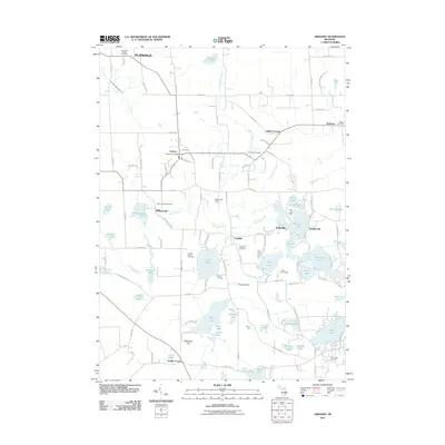
2011 Map of Gregory
USGS Topo · Published 2011About this map
The unincorporated community of Gregory and the rural crossroads of Unadilla anchor this southern Michigan landscape, which is defined by an extensive network of glacial kettle lakes and wetlands. The southern half of the quadrangle is notably densely packed with water bodies, including Joslin Lake, Bruin Lake, Halfmoon Lake, and North Lake. These lakes are accompanied by several recreational sites and youth camps, such as Camp Munhacke and Camp Grindley, illustrating the area's long-standing role as a summer destination. To the north, the terrain transitions into a more agricultural pattern around Plainfield and Bullis Crossing, where the Gregory Post Office serves as a central landmark. For those researching local families, the map identifies numerous small burial grounds, from the Plainfield Village Cemetery in the north to the North Lake Cemetery near the southern boundary, providing a clear geography of early settlement pockets.
Find a feature on this map
110 named features on this map. Tap any name to fly to it.
Don’t see what you’re looking for? This feature index may not catch every label — zoom into the map to look around manually.
Map Details
Editions of this 2011 Gregory Map
This is the sole edition of this map. No revisions or reprints were ever made.
Other maps of this area

1902 · Dexter
USGS Topo · 1:62,500

1904 · Ann Arbor
USGS Topo · 1:125,000

1906 · Dexter
USGS Topo · 1:62,500

1907 · Howell
USGS Topo · 1:62,500

1908 · Ann Arbor
USGS Topo · 1:125,000

1908 · Fowlerville
USGS Topo · 1:62,500

1909 · Howell
USGS Topo · 1:62,500

1910 · Fowlerville
USGS Topo · 1:62,500

1919 · Stockbridge
USGS Topo · 1:62,500

1922 · Stockbridge
USGS Topo · 1:62,500
Featured Places
- Putnam Township, MI
- Dexter Township, MI
- Unadilla, Unadilla Township
- Unadilla Township, MI
- Lyndon Township, MI