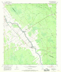
1954 Map of Grosse Tete
USGS Topo · Published 1970About this map
Bayou Grosse Tete flows through the heart of this landscape, anchoring a network of small settlements and agricultural plots along the borders of Pointe Coupee Parish, West Baton Rouge Parish, and Iberville Parish. The Texas and Pacific railroad parallels the waterway, connecting the communities of Rosedale, Grosse Tete, Webre, and Slacks. This mid-century survey reflects a deeply utilized floodplain, where extensive spoil banks and drainage features like King Ditch and Catfish Canal reveal the ongoing efforts to manage the wet Louisiana terrain for commerce and habitation.
Find a feature on this map
29 named features on this map. Tap any name to fly to it.
Don’t see what you’re looking for? This feature index may not catch every label — zoom into the map to look around manually.
Map Details
Editions of this 1954 Grosse Tete Map
4 editions found

Other maps of this area

1906 · Bayou Sara
USGS Topo · 1:125,000

1935 · Osca Bayou
USGS Topo · 1:62,500

1939 · Fordoche
USGS Topo · 1:62,500

1940 · Grosse Tete
USGS Topo · 1:62,500

1953 · Cow Bayou
USGS Topo · 1:24,000

1953 · Lobdell
USGS Topo · 1:24,000

1953 · Maringouin
USGS Topo · 1:24,000

1953 · Addis
USGS Topo · 1:24,000

1953 · Grosse Tete SW
USGS Topo · 1:24,000

1954 · Walls
USGS Topo · 1:24,000