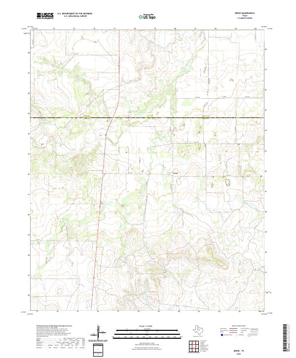
2022 Map of Grow
USGS Topo · Published 2022About this map
The tiny community of Grow sits near the intersection of several local roads in northern King Co, just south of the boundary with Cottle Co. This rural landscape is defined by the drainage basins of the Wichita River system. The N Wichita River meanders across the northern half of the sheet, while the Middle Fork Wichita River cuts through the southwestern corner. These waterways are joined by numerous smaller tributaries, including Buford Br and Farrer Cr. The road network, consisting of routes like FM 1168 and various county roads such as Co RD 202, follows the higher ground between these winding stream valleys. This survey provides a modern view of the sparsely populated ranching and farming country on the eastern edge of the Texas Panhandle region.
Find a feature on this map
18 named features on this map. Tap any name to fly to it.
Don’t see what you’re looking for? This feature index may not catch every label — zoom into the map to look around manually.
Map Details
Editions of this 2022 Grow Map
This is the sole edition of this map. No revisions or reprints were ever made.
Other maps of this area

1954 · Lubbock
USGS Topo · 1:250,000

1966 · Chalk SW
USGS Topo · 1:24,000

1966 · J Y Ranch
USGS Topo · 1:24,000

1967 · Guthrie NW
USGS Topo · 1:24,000

1967 · Fourmile Hill
USGS Topo · 1:24,000

1968 · Grow
USGS Topo · 1:24,000
1968 · Chalk
USGS Topo · 1:24,000

1968 · Buffalo Creek
USGS Topo · 1:24,000

1968 · Grow NW
USGS Topo · 1:24,000
1968 · Ginsite
USGS Topo · 1:24,000