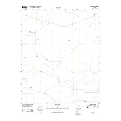
2010 Map of Grow NW
USGS Topo · Published 2010About this map
Valley View and Delwin anchor the corners of this cattle country landscape in Cottle County, where the infrastructure of ranching is the primary mark on the land. This terrain is defined by a network of drainage systems including Buck Creek, Mesa Creek, and South Buck Creek, which guide the placement of numerous functional landmarks. The high frequency of named water-drawing features, such as Steel Pen Windmill, East Herd Windmill, and Shorty Smock Windmill, indicates an area where water management is vital for livestock and survival.
Find a feature on this map
27 named features on this map. Tap any name to fly to it.
Don’t see what you’re looking for? This feature index may not catch every label — zoom into the map to look around manually.
Map Details
Editions of this 2010 Grow NW Map
This is the sole edition of this map. No revisions or reprints were ever made.
Other maps of this area

1954 · Lubbock
USGS Topo · 1:250,000

1954 · Plainview
USGS Topo · 1:250,000

1958 · Plainview
USGS Topo · 1:250,000

1966 · Tee Pee City
USGS Topo · 1:24,000

1966 · Devils Canyon
USGS Topo · 1:24,000

1967 · Paducah
USGS Topo · 1:24,000

1968 · Grow
USGS Topo · 1:24,000

1968 · Buffalo Creek
USGS Topo · 1:24,000

1968 · Grow NW
USGS Topo · 1:24,000

1968 · Dumont
USGS Topo · 1:24,000