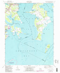
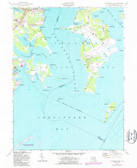
1949 Map of Gunpowder Neck
USGS Topo · Published 1987About this map
The Gunpowder River and Bush River dominate this coastal landscape at the edge of the Chesapeake Bay, where tidal creeks and marshy points define the mid-century shoreline of Harford and Baltimore Counties. The 1949 data reflects a region balanced between recreation and military utility, with Gunpowder Falls State Park and Seneca Park situated near significant military reservation boundaries. Industrial and transport footprints are evident in the Conrail lines featuring electrified tracks passing through Chase Station and Harewood Station. Off the tip of the Gunpowder Neck, Pooles Island stands with its recorded tower and lighthouse, while Carroll Island and Graces Quarters mark the complex network of coves and points that have historically served as both strategic outposts and local fishing grounds.
Find a feature on this map
59 named features on this map. Tap any name to fly to it.
Don’t see what you’re looking for? This feature index may not catch every label — zoom into the map to look around manually.
Map Details
Editions of this 1949 Gunpowder Neck Map
5 editions found
Other maps of this area

1893 · North Point
USGS Topo · 1:62,500

1893 · Gunpowder
USGS Topo · 1:62,500

1898 · Tolchester
USGS Topo · 1:125,000

1900 · Betterton
USGS Topo · 1:62,500

1901 · Chestertown
USGS Topo · 1:62,500

1901 · Gunpowder
USGS Topo · 1:62,500

1903 · Tolchester
USGS Topo · 1:125,000

1904 · North Point
USGS Topo · 1:62,500

1908 · Tolchester
USGS Topo · 1:125,000

1920 · Chestertown
USGS Topo · 1:62,500