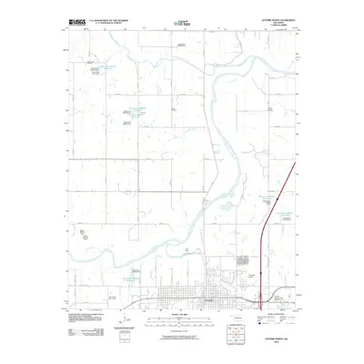
2009 Map of Guthrie North
USGS Topo · Published 2009About this map
The Cimarron River winds through this Logan County landscape just north of the city of Guthrie, which occupies the southern portion of the sheet. The settlement pattern reflects a mix of municipal expansion and rural utility, with the Guthrie street grid extending toward Bird Creek and Cottonwood Creek. To the north, the terrain is defined by water management and resource extraction, evidenced by the West Lawrie Oil Field and a series of numbered reservoirs like Oknoname 083033 Reservoir. Local history is anchored by several burial grounds, including the large Summit View Cemetery and the smaller Lawrie Cemetery. The map also captures infrastructure such as Chappell Airport and the small lakeside community at Camp Joy, illustrating the region's development as a transition between the urban center and the surrounding agricultural and industrial creek basins.
Find a feature on this map
60 named features on this map. Tap any name to fly to it.
Don’t see what you’re looking for? This feature index may not catch every label — zoom into the map to look around manually.
Map Details
Editions of this 2009 Guthrie North Map
This is the sole edition of this map. No revisions or reprints were ever made.
Other maps of this area

1892 · Guthrie
USGS Topo · 1:62,500

1892 · Kingfisher
USGS Topo · 1:125,000

1893 · Mulhall
USGS Topo · 1:62,500

1893 · Lovell
USGS Topo · 1:62,500

1895 · Kingfisher
USGS Topo · 1:125,000

1954 · Oklahoma City
USGS Topo · 1:250,000

1955 · Enid
USGS Topo · 1:250,000

1957 · Oklahoma City
USGS Topo · 1:250,000

1958 · Enid
USGS Topo · 1:250,000

1963 · Oklahoma City
USGS Topo · 1:250,000