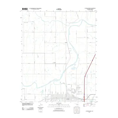
2012 Map of Guthrie North
USGS Topo · Published 2012About this map
The Cimarron River winds through the heart of this Logan County landscape, joined by its tributaries Skeleton Cr, Cottonwood Cr, and Lawrie Cr. This survey captures the northern expansion of Guthrie, showing the grid of the city reaching toward the riverbanks near Summit View Cem and Memory Gardens Memorial Park. To the north, the small settlement of Lawrie and the West Lawrie Oil Field illustrate the region's enduring connection to the petroleum industry. Genealogists will find a high density of burial grounds throughout the area, including the Rosenwald Community Cem and Camp Russell Cem, providing valuable spatial context for local family histories. The presence of Chappell Airport and Country Club Lake further reflects the modern development patterns north of the historic territorial capital.
Find a feature on this map
72 named features on this map. Tap any name to fly to it.
Don’t see what you’re looking for? This feature index may not catch every label — zoom into the map to look around manually.
Map Details
Editions of this 2012 Guthrie North Map
This is the sole edition of this map. No revisions or reprints were ever made.
Other maps of this area

1892 · Guthrie
USGS Topo · 1:62,500

1892 · Kingfisher
USGS Topo · 1:125,000

1893 · Mulhall
USGS Topo · 1:62,500

1893 · Lovell
USGS Topo · 1:62,500

1895 · Kingfisher
USGS Topo · 1:125,000

1954 · Oklahoma City
USGS Topo · 1:250,000

1955 · Enid
USGS Topo · 1:250,000

1957 · Oklahoma City
USGS Topo · 1:250,000

1958 · Enid
USGS Topo · 1:250,000

1963 · Oklahoma City
USGS Topo · 1:250,000