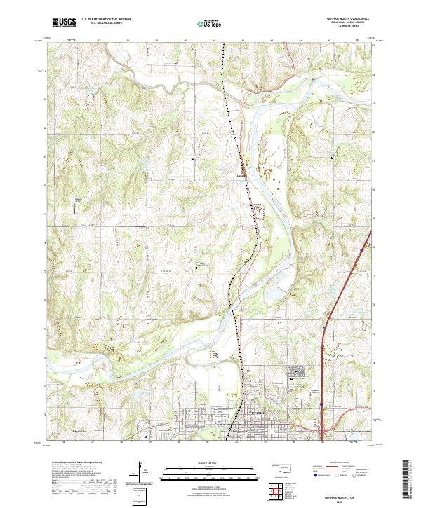
2022 Map of Guthrie North
USGS Topo · Published 2022About this map
Guthrie serves as the focal point of this Logan County landscape, centered on the historic district where the Logan County Courthouse stands. The urban street grid transitions into a riverine environment dominated by the Cimarron River, which meanders through the central portion of the sheet. The settlement patterns reflect a blend of municipal development and rural homesteads, with several significant burial sites like Summit View Cem and the Rosenwald Community Cem providing critical data points for genealogical research.
Find a feature on this map
64 named features on this map. Tap any name to fly to it.
Don’t see what you’re looking for? This feature index may not catch every label — zoom into the map to look around manually.
Map Details
Editions of this 2022 Guthrie North Map
This is the sole edition of this map. No revisions or reprints were ever made.
Other maps of this area

1892 · Guthrie
USGS Topo · 1:62,500

1892 · Kingfisher
USGS Topo · 1:125,000

1893 · Mulhall
USGS Topo · 1:62,500

1893 · Lovell
USGS Topo · 1:62,500

1895 · Kingfisher
USGS Topo · 1:125,000

1954 · Oklahoma City
USGS Topo · 1:250,000

1955 · Enid
USGS Topo · 1:250,000

1957 · Oklahoma City
USGS Topo · 1:250,000

1958 · Enid
USGS Topo · 1:250,000

1963 · Oklahoma City
USGS Topo · 1:250,000