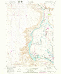
1949 Map of Hagerman
USGS Topo · Published 1978About this map
Hagerman Valley serves as a focal point for water management and hydroelectric development along the Snake River in the late 1940s. The landscape is defined by the complex system of irrigation and power production, featuring the Lower Salmon Falls and Upper Salmon Falls dams and power plants. This period shows a transitional hydrology, most notably at Bell Rapids, which is marked as submerged following the construction of downriver barriers.
Find a feature on this map
36 named features on this map. Tap any name to fly to it.
Don’t see what you’re looking for? This feature index may not catch every label — zoom into the map to look around manually.
Map Details
Editions of this 1949 Hagerman Map
4 editions found
Other maps of this area

1948 · Ticeska
USGS Topo · 1:24,000

1949 · Ticeska
USGS Topo · 1:24,000

1949 · Pasadena Valley
USGS Topo · 1:62,500

1949 · Bliss
USGS Topo · 1:24,000

1949 · Thousand Springs
USGS Topo · 1:24,000

1949 · Gooding Butte
USGS Topo · 1:24,000

1949 · Tuttle
USGS Topo · 1:24,000

1949 · Hagerman
USGS Topo · 1:24,000

1949 · Indian Butte
USGS Topo · 1:24,000

1950 · Gooding Butte
USGS Topo · 1:24,000