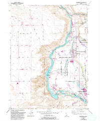
1949 Map of Hagerman
USGS Topo · Published 1992About this map
The Snake River carves a deep path through the Hagerman Valley, defining the region's character as a hub for both ancient paleontology and modern hydroelectric power. This landscape is home to the Hagerman Fossil Beds National Monument, where Fossil Gulch and Peters Gulch reveal the geological history of the Snake River Plain. Near the town of Hagerman, the river's descent is harnessed by facilities such as the Lower Salmon Falls Power Plant and the Upper Salmon Falls Power Plant, illustrating the industrial significance of the canyon floor.
Find a feature on this map
38 named features on this map. Tap any name to fly to it.
Don’t see what you’re looking for? This feature index may not catch every label — zoom into the map to look around manually.
Map Details
Editions of this 1949 Hagerman Map
4 editions found
Other maps of this area

1948 · Ticeska
USGS Topo · 1:24,000

1949 · Ticeska
USGS Topo · 1:24,000

1949 · Pasadena Valley
USGS Topo · 1:62,500

1949 · Bliss
USGS Topo · 1:24,000

1949 · Thousand Springs
USGS Topo · 1:24,000

1949 · Gooding Butte
USGS Topo · 1:24,000

1949 · Tuttle
USGS Topo · 1:24,000

1949 · Hagerman
USGS Topo · 1:24,000

1949 · Indian Butte
USGS Topo · 1:24,000

1950 · Gooding Butte
USGS Topo · 1:24,000