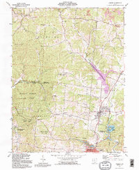
1992 Map of Hamden
USGS Topo · Published 1995About this map
The rolling landscape of Vinton and Jackson Counties is defined by the extensive Richland Furnace State Forest and the industrial legacies of extraction. This survey reveals a terrain carved by both nature and human effort, featuring numerous strip mines and gas wells alongside established rural communities. Cultural landmarks like Antioch Ch and the Washington Sch anchor the small settlements, while the presence of the Richland Furnace site points to the region's historical iron industry. Water management and recreation are central to the area's layout, highlighted by the large expanse of Lake Rupert and the nearby Lake Alma State Park. From the Reed Hill Lookout Tower to the various family-named burial grounds like Martindill Cem and Wyckoff Cem, the map documents a place where public forestry, resource extraction, and local genealogy intersect.
Find a feature on this map
50 named features on this map. Tap any name to fly to it.
Don’t see what you’re looking for? This feature index may not catch every label — zoom into the map to look around manually.
Map Details
Editions of this 1992 Hamden Map
This is the sole edition of this map. No revisions or reprints were ever made.
Other maps of this area

1904 · Zaleski
USGS Topo · 1:62,500

1905 · Wilkesville
USGS Topo · 1:62,500

1907 · Zaleski
USGS Topo · 1:62,500

1908 · Wilkesville
USGS Topo · 1:62,500

1910 · Laurelville
USGS Topo · 1:62,500

1912 · Laurelville
USGS Topo · 1:62,500

1913 · Jackson
USGS Topo · 1:62,500

1944 · Jackson
USGS Topo · 1:62,500

1944 · Laurelville
USGS Topo · 1:62,500

1947 · Columbus
USGS Topo · 1:250,000