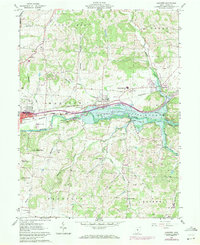
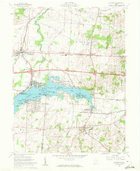
1961 Map of Hanover
USGS Topo · Published 1971About this map
Dillon Reservoir and the Licking River dominate this eastern Licking County landscape, illustrating a period of significant water management and infrastructure expansion. The map details the valley just as the reservoir's normal pool elevation is established, affecting the surrounding settlements of Hanover and Claylick. Transportation corridors are well-defined by the Baltimore and Ohio Railroad and the Penn Central lines which skirt the northern banks and the dramatic topography of the Licking Gorge. Local community life is evidenced by numerous rural institutions, including Mount Carmel Ch and Licking Valley High Sch. The terrain transitions from the river flats to prominent heights like Bucks Knob and Bald Knob, while smaller watercourses like Claylick Creek and Rocky Fork carve through the townships of Mary Ann, Madison, and Hopewell.
Find a feature on this map
53 named features on this map. Tap any name to fly to it.
Don’t see what you’re looking for? This feature index may not catch every label — zoom into the map to look around manually.
Map Details
Editions of this 1961 Hanover Map
5 editions found
Other maps of this area

1909 · Newark
USGS Topo · 1:62,500

1909 · Thornville
USGS Topo · 1:62,500

1910 · Frazeysburg
USGS Topo · 1:62,500

1910 · Zanesville
USGS Topo · 1:62,500

1947 · Columbus
USGS Topo · 1:250,000

1950 · Marion
USGS Topo · 1:250,000

1961 · Columbus
USGS Topo · 1:250,000

1961 · Hanover
USGS Topo · 1:24,000

1961 · Newark
USGS Topo · 1:24,000
1961 · Thornville
USGS Topo · 1:24,000