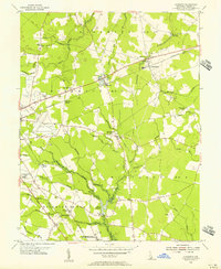
1955 Map of Harbeson
USGS Topo · Published 1956About this map
Agricultural life and rural infrastructure define this Sussex County landscape in the mid-1950s. The Pennsylvania railroad line cuts diagonally through the terrain, anchoring small settlements like Harbeson and Broadkill Sta, while the Dupont Highway runs south toward Stockley. The map records a variety of local landmarks, including the Delaware Colony State Training School, the County Prison Farm, and the Georgetown Municipal Airport on the western edge.
Find a feature on this map
62 named features on this map. Tap any name to fly to it.
Don’t see what you’re looking for? This feature index may not catch every label — zoom into the map to look around manually.
Map Details
Editions of this 1955 Harbeson Map
4 editions found
Other maps of this area

1917 · Millsboro
USGS Topo · 1:62,500

1918 · Cedar Creek
USGS Topo · 1:62,500

1918 · Rehoboth
USGS Topo · 1:62,500

1918 · Cape Henlopen
USGS Topo · 1:62,500

1919 · Cedar Creek
USGS Topo · 1:62,500

1937 · Cape Henlopen
USGS Topo · 1:62,500

1938 · Cedar Creek
USGS Topo · 1:62,500

1938 · Millsboro
USGS Topo · 1:62,500

1938 · Rehoboth
USGS Topo · 1:62,500

1943 · Fairmount
USGS Topo · 1:24,000