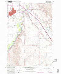
1960 Map of Hardin
USGS Topo · Published 1980About this map
The confluence of the Bighorn River and the Little Bighorn River forms the geographical heart of this Big Horn County region. In the northwestern corner, the city of Hardin appears as a developed hub featuring the St Joseph Ch, the Court House, and the Memorial Hospital. The landscape is a mix of agricultural enterprise and historical memory, evidenced by the intricate network of the Agency Canal and Farmers Canal supporting local farms, and the presence of the Historical Mon (Site of Fort Custer) marking the site of a 19th-century military outpost.
Find a feature on this map
37 named features on this map. Tap any name to fly to it.
Don’t see what you’re looking for? This feature index may not catch every label — zoom into the map to look around manually.
Map Details
Editions of this 1960 Hardin Map
Other maps of this area

1894 · Fort Custer
USGS Topo · 1:125,000

1954 · Hardin
USGS Topo · 1:250,000

1957 · Hardin
USGS Topo · 1:250,000

1958 · Hardin
USGS Topo · 1:250,000

1960 · Ninemile Point
USGS Topo · 1:24,000

1960 · Chimney Creek
USGS Topo · 1:24,000

1960 · Walker Hill
USGS Topo · 1:24,000

1960 · Hardin
USGS Topo · 1:24,000
1960 · Prante Ranch
USGS Topo · 1:24,000

1960 · Hardin SW
USGS Topo · 1:24,000