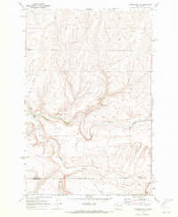
1969 Map of Harrington SE
USGS Topo · Published 1972About this map
Crab Creek and its South Fork carve a distinct drainage system through this portion of the Channeled Scablands as it appeared in the late 1960s. The landscape is defined by an intricate network of local access roads named for area families and pioneers, including Klein Road, Bauman Rd, and Sage Road. While largely agricultural, the terrain shows evidence of localized industry through numerous scattered Gravel Pits and Borrow Pits near the watercourses. A significant geographic marker is the crossing at Rocky Ford Bridge, which serves as a fixed point in an area otherwise characterized by winding coulees and seasonal water features like the aptly named Spring. The map also captures the administrative boundary between Lincoln County and Adams County in the southern reaches of the quadrangle.
Find a feature on this map
16 named features on this map. Tap any name to fly to it.
Don’t see what you’re looking for? This feature index may not catch every label — zoom into the map to look around manually.
Map Details
Editions of this 1969 Harrington SE Map
2 editions found
Other maps of this area

1953 · Ritzville
USGS Topo · 1:250,000

1959 · Ritzville
USGS Topo · 1:250,000

1964 · Karakul Hills
USGS Topo · 1:24,000

1965 · Ritzville
USGS Topo · 1:250,000

1967 · Ritzville NE
USGS Topo · 1:24,000

1967 · Ritzville NW
USGS Topo · 1:24,000

1969 · Harrington
USGS Topo · 1:24,000

1969 · Lords Valley
USGS Topo · 1:24,000

1969 · Cormana Lake
USGS Topo · 1:24,000

1969 · Lamona
USGS Topo · 1:24,000