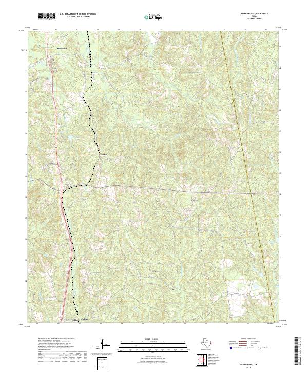
2022 Map of Harrisburg
USGS Topo · Published 2022About this map
Browndell and Horton anchor the landscape of this East Texas timber and creek country, where the undulating terrain is defined by a dense network of watercourses. The boundary between Jasper Co and Newton Co runs north-to-south through the eastern half of the quadrangle, crossing the waters of Big Cow Cr and Hardy Cr. Settlement patterns are largely rural, with a web of county roads like Co RD 230 and Old 8 connecting family homesteads and local landmarks such as Frisby Cem. The drainage of Mill Cr and its various tributaries, including Little Cr and Seay Lake, shapes the local geography, suggesting a history tied to the land's natural contours and hydrology. Further south, the community of Collins sits near the crossing of Sandy Cr, illustrating the typical placement of early Texas settlements along reliable water sources.
Find a feature on this map
45 named features on this map. Tap any name to fly to it.
Don’t see what you’re looking for? This feature index may not catch every label — zoom into the map to look around manually.
Map Details
Editions of this 2022 Harrisburg Map
This is the sole edition of this map. No revisions or reprints were ever made.
Other maps of this area

1952 · Lake Charles
USGS Topo · 1:250,000

1953 · Alexandria
USGS Topo · 1:250,000

1953 · Palestine
USGS Topo · 1:250,000

1954 · Lake Charles
USGS Topo · 1:250,000

1954 · Beaumont
USGS Topo · 1:250,000

1955 · Alexandria
USGS Topo · 1:250,000

1955 · Roganville
USGS Topo · 1:62,500

1955 · Curtis
USGS Topo · 1:62,500

1957 · Beaumont
USGS Topo · 1:250,000

1957 · Palestine
USGS Topo · 1:250,000