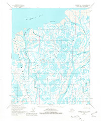
1955 Map of Harrison Bay B-2
USGS Topo · Published 1981About this map
The Colville River Delta dominates this mid-century Arctic landscape, where a complex network of waterways meets the shallow waters of Harrison Bay. The area is characterized by its intricate hydrology, including the Nechelik Channel and Kachemach River, which wind through a terrain of low-lying tundra and countless small ponds. Within the western portion of the sheet lies the National Petroleum Reserve in Alaska, a designation that reflects the region's strategic energy importance. Human presence is sparse, marked only by isolated Cabins near the channels and prominent coastal landmarks like Tolaktovut Point and Anajuk Point. Unique geographical features such as Kachemach Mound and Oil Lake stand out as notable landforms in this remote coastal environment, surveyed just as Arctic exploration was intensifying.
Find a feature on this map
18 named features on this map. Tap any name to fly to it.
Don’t see what you’re looking for? This feature index may not catch every label — zoom into the map to look around manually.
Map Details
Editions of this 1955 Harrison Bay B-2 Map
2 editions found
Other maps of this area

1951 · Harrison Bay
USGS Topo · 1:250,000

1955 · Harrison Bay
USGS Topo · 1:250,000

1955 · Harrison Bay C-1
USGS Topo · 1:63,360

1955 · Harrison Bay B-3
USGS Topo · 1:63,360
1955 · Harrison Bay C-3
USGS Topo · 1:63,360

1955 · Harrison Bay B-2
USGS Topo · 1:63,360

1955 · Harrison Bay B-1
USGS Topo · 1:63,360

1955 · Harrison Bay A-2
USGS Topo · 1:63,360

1955 · Harrison Bay A-3
USGS Topo · 1:63,360
1955 · Harrison Bay A-1
USGS Topo · 1:63,360