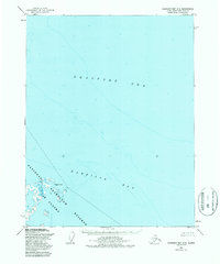
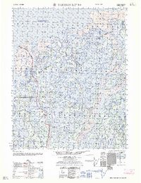
1955 Map of Harrison Bay C-3
USGS Topo · Published 1987About this map
Harrison Bay and the Beaufort Sea dominate this mid-century coastal survey of Alaska's North Slope. The shoreline is defined by the protrusion of Atigaru Point, which separates the open sea from the shallower waters of the bay. In the interior, the National Petroleum Reserve in Alaska encompasses a landscape marked by numerous small lakes, ponds, and marshy terrain labeled as Mud. A lone Drill Hole near the coast provides a clear indicator of early industrial exploration in this Arctic region during the mid-1950s. The map illustrates the specialized hydrographic data of the era, focusing on coastal depth soundings and the intricate, shifting nature of the shoreline where land meets the Arctic waters.
Find a feature on this map
6 named features on this map. Tap any name to fly to it.
Don’t see what you’re looking for? This feature index may not catch every label — zoom into the map to look around manually.
Map Details
Editions of this 1955 Harrison Bay C-3 Map
3 editions found
Other maps of this area

1951 · Harrison Bay
USGS Topo · 1:250,000

1955 · Harrison Bay
USGS Topo · 1:250,000

1955 · Harrison Bay B-3
USGS Topo · 1:63,360

1955 · Harrison Bay D-4
USGS Topo · 1:63,360
1955 · Harrison Bay C-3
USGS Topo · 1:63,360

1955 · Harrison Bay B-2
USGS Topo · 1:63,360

1955 · Harrison Bay C-4
USGS Topo · 1:63,360

1955 · Harrison Bay B-4
USGS Topo · 1:63,360
1962 · Harrison Bay C-3
USGS Topo · 1:50,000
1962 · Harrison Bay B-2
USGS Topo · 1:50,000