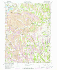
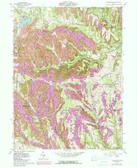
1960 Map of Harrisville
USGS Topo · Published 1978About this map
Strip mines dominate this mid-century landscape of Harrison and Belmont Counties, revealing a terrain heavily transformed by industrial coal extraction. The Georgetown Coal Preparation Plant stands as a central industrial hub near Georgetown (Short Creek PO), where the Norfolk and Western and Penn Central rail lines intersect to transport resources out of the Short Creek and Wheeling Creek valleys.
Find a feature on this map
71 named features on this map. Tap any name to fly to it.
Don’t see what you’re looking for? This feature index may not catch every label — zoom into the map to look around manually.
Map Details
Editions of this 1960 Harrisville Map
5 editions found
Other maps of this area

1901 · Cadiz
USGS Topo · 1:62,500

1902 · Scio
USGS Topo · 1:62,500

1903 · Cadiz
USGS Topo · 1:62,500

1903 · Flushing
USGS Topo · 1:62,500

1904 · Scio
USGS Topo · 1:62,500

1905 · St. Clairsville
USGS Topo · 1:62,500

1905 · Flushing
USGS Topo · 1:62,500

1951 · Canton
USGS Topo · 1:250,000

1953 · Canton
USGS Topo · 1:250,000

1957 · Canton
USGS Topo · 1:250,000