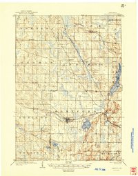
1904 Map of Hartford
USGS Topo · Published 1946About this map
The glacial landscape of southeastern Wisconsin at the turn of the century is defined by a dense network of small dairy-era settlements and intersecting rail lines. Hartford serves as a central hub, where the Chicago Milwaukee and St. Paul R.R. cuts through the river valley. To the east, the village of Schleisingerville marks a critical junction for the Wisconsin Central R.R. and the Chicago Northern Division R.R., illustrating the region's early importance as a transportation corridor between Milwaukee and the interior. Notable elevations like Holy Hill and the shoreline points of Cedar Lake, including Linden Pt. and Echo Pt., stand out against the agricultural backdrop of Addison and Rubicon. Small hamlets such as Hochheim, Nenno, and Huilsburg provide valuable location data for genealogists tracing family roots in these township sections before modern highway expansion altered the local geography.
Find a feature on this map
47 named features on this map. Tap any name to fly to it.
Don’t see what you’re looking for? This feature index may not catch every label — zoom into the map to look around manually.
Map Details
Editions of this 1904 Hartford Map
3 editions found
Other maps of this area

1892 · Waukesha
USGS Topo · 1:62,500

1892 · Watertown
USGS Topo · 1:62,500

1892 · Oconomowoc
USGS Topo · 1:62,500

1894 · Watertown
USGS Topo · 1:62,500

1901 · Waukesha
USGS Topo · 1:62,500

1904 · West Bend
USGS Topo · 1:62,500

1904 · Hartford
USGS Topo · 1:62,500

1906 · Waukesha
USGS Topo · 1:62,500

1909 · Oconomowoc
USGS Topo · 1:62,500

1955 · Waupun
USGS Topo · 1:62,500