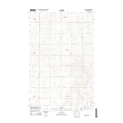
2014 Map of Hartline SE
USGS Topo · Published 2014About this map
Wilson Cr carves a subtle path through the southeastern corner of this landscape, representing the primary drainage in an area defined by a rigorous grid of section lines and gravel roads. Located in the heart of the Columbia Plateau, the terrain is shaped by the Public Land Survey System, with township boundaries like t24n r30e and t25n r30e organizing the dryland wheat country. The infrastructure is almost entirely agricultural, featuring a systematic network of thoroughfares including Road 36 NE, 35-NE Rd, and Road 34 NE that facilitate movement between expansive fields. This 2014 survey documents the enduring spatial logic of Washington's interior farm country, where the landscape is etched into precise rectangles that dictate the placement of every homestead and field.
Find a feature on this map
16 named features on this map. Tap any name to fly to it.
Don’t see what you’re looking for? This feature index may not catch every label — zoom into the map to look around manually.
Map Details
Editions of this 2014 Hartline SE Map
This is the sole edition of this map. No revisions or reprints were ever made.
Other maps of this area

1953 · Ritzville
USGS Topo · 1:250,000

1956 · Wilson Creek NW
USGS Topo · 1:24,000

1956 · Wilson Creek
USGS Topo · 1:62,500

1959 · Ritzville
USGS Topo · 1:250,000

1965 · Ritzville
USGS Topo · 1:250,000

1968 · Hartline
USGS Topo · 1:24,000

1968 · Hartline SW
USGS Topo · 1:24,000

1968 · Marlin
USGS Topo · 1:24,000

1968 · Hartline SE
USGS Topo · 1:24,000
1968 · Hartline NW
USGS Topo · 1:24,000