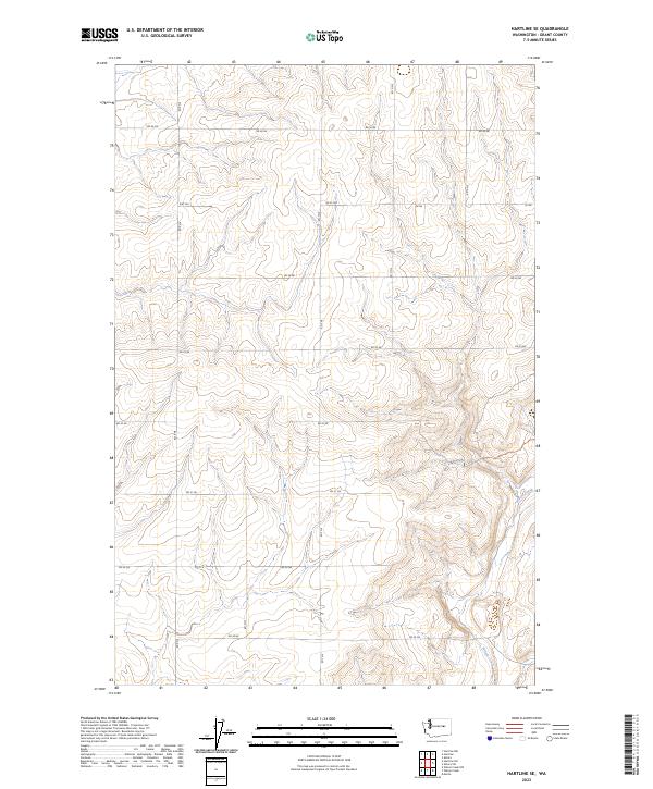
2023 Map of Hartline SE
USGS Topo · Published 2023About this map
Wilson Creek meanders through the southeastern portion of this landscape, carving a natural drainage through the otherwise structured grid of the high plateau. The area is defined by an extensive network of rural routes, including primary east-west thoroughfares like Rd 36 Ne and Rd 33 Ne, which facilitate movement across this agricultural and ranching terrain. The survey captures the intersection of natural topography and human geometry, where the sharp relief of coulees and draws contrasts with the precise boundaries of townships such as t24n r30e. While much of the travel is handled by established roads, the presence of a Dirt Trl in the northwest suggests more localized access points to the interior land. This modern update by the U.S. Geological Survey provides a precise record of the drainage patterns and transportation infrastructure in this part of Grant County.
Find a feature on this map
21 named features on this map. Tap any name to fly to it.
Don’t see what you’re looking for? This feature index may not catch every label — zoom into the map to look around manually.
Map Details
Editions of this 2023 Hartline SE Map
This is the sole edition of this map. No revisions or reprints were ever made.
Other maps of this area

1953 · Ritzville
USGS Topo · 1:250,000

1956 · Wilson Creek NW
USGS Topo · 1:24,000

1956 · Wilson Creek
USGS Topo · 1:62,500

1959 · Ritzville
USGS Topo · 1:250,000

1965 · Ritzville
USGS Topo · 1:250,000

1968 · Hartline
USGS Topo · 1:24,000

1968 · Hartline SW
USGS Topo · 1:24,000

1968 · Marlin
USGS Topo · 1:24,000

1968 · Hartline SE
USGS Topo · 1:24,000
1968 · Hartline NW
USGS Topo · 1:24,000