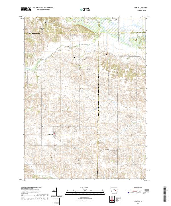
2022 Map of Hartwick
USGS Topo · Published 2022About this map
The Iowa River corridor and its surrounding agricultural uplands define this section of the Iowa interior, where the small settlement of Hartwick serves as a primary local landmark. The landscape is deeply carved by a network of drainage systems, including the westward-flowing Walnut Creek and the meandering Honey Cr. This area is particularly rich in family and pioneer history, evidenced by a high density of rural burial grounds such as Dover Pioneer Cem, Winslow Cem, and Chambers Cem that dot the section lines.
Find a feature on this map
45 named features on this map. Tap any name to fly to it.
Don’t see what you’re looking for? This feature index may not catch every label — zoom into the map to look around manually.
Map Details
Editions of this 2022 Hartwick Map
This is the sole edition of this map. No revisions or reprints were ever made.
Other maps of this area

1954 · Des Moines
USGS Topo · 1:250,000

1956 · Des Moines
USGS Topo · 1:250,000

1957 · Des Moines
USGS Topo · 1:250,000

1965 · Ladora
USGS Topo · 1:24,000

1965 · Keystone South
USGS Topo · 1:24,000

1968 · Brooklyn
USGS Topo · 1:24,000

1968 · Belle Plaine SW
USGS Topo · 1:24,000

1968 · Victor
USGS Topo · 1:24,000

1968 · Belle Plaine
USGS Topo · 1:24,000

1968 · Chelsea
USGS Topo · 1:24,000