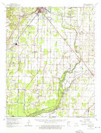
1964 Map of Harviell
USGS Topo · Published 1976About this map
Harviell and Qulin serve as the primary hubs in this mid-1960s landscape, where the St Louis San Francisco and Missouri Pacific railroads intersect a complex network of wetlands and sloughs. The geography is defined by the winding course of the Black River and the engineered drainage of the Little River valley, punctuated by dozens of rural landmarks that reveal the social fabric of the era. Genealogists will find a wealth of specific sites, from the Hyam Cem and Melton Cem to local spiritual centers like Stilleamp Ch and New Morning Star Ch. The area is notably dense with small educational centers such as Willow Oak Sch and Coon Island Sch, reflecting a distributed rural population before the consolidation of the late 20th century. To the southeast, the terrain shifts near Fagus as the Fish Trap Slough and Meander River meet the Butler and Clay county line at the Arkansas border.
Find a feature on this map
87 named features on this map. Tap any name to fly to it.
Don’t see what you’re looking for? This feature index may not catch every label — zoom into the map to look around manually.
Map Details
Editions of this 1964 Harviell Map
3 editions found
Other maps of this area

1934 · Williamsville
USGS Topo · 1:48,000

1934 · Puxico
USGS Topo · 1:62,500

1935 · Poplar Bluff
USGS Topo · 1:62,500

1935 · Acorn
USGS Topo · 1:62,500

1935 · Rector
USGS Topo · 1:62,500

1935 · Knobel
USGS Topo · 1:62,500

1935 · Harviell
USGS Topo · 1:62,500

1939 · Puxico
USGS Topo · 1:62,500

1939 · Poplar Bluff
USGS Topo · 1:62,500

1940 · Williamsville
USGS Topo · 1:62,500