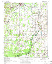
1964 Map of Harviell
USGS Topo · Published 1981About this map
Poplar Bluff anchors the northern edge of this survey, where the heavy rail infrastructure of the St Louis-San Francisco Missouri Pacific lines converges. Moving south toward the Missouri Arkansas border, the landscape transforms into a complex network of waterways and drainage sloughs, including Big Slough and Caney Slough. The rural character of Butler County is defined by a high density of small community centers, evidenced by numerous country churches such as New Light Ch, Tabernacle of Charity, and Friendship Ch.
Find a feature on this map
93 named features on this map. Tap any name to fly to it.
Don’t see what you’re looking for? This feature index may not catch every label — zoom into the map to look around manually.
Map Details
Editions of this 1964 Harviell Map
3 editions found
Other maps of this area

1934 · Williamsville
USGS Topo · 1:48,000

1934 · Puxico
USGS Topo · 1:62,500

1935 · Poplar Bluff
USGS Topo · 1:62,500

1935 · Acorn
USGS Topo · 1:62,500

1935 · Rector
USGS Topo · 1:62,500

1935 · Knobel
USGS Topo · 1:62,500

1935 · Harviell
USGS Topo · 1:62,500

1939 · Puxico
USGS Topo · 1:62,500

1939 · Poplar Bluff
USGS Topo · 1:62,500

1940 · Williamsville
USGS Topo · 1:62,500