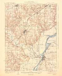
1925 Map of Havana
USGS Topo · Published 1925About this map
Havana and Lewistown anchor this 1920s landscape at the confluence of the Illinois River and Spoon River. The map reveals a densely settled agricultural and industrial region across Fulton and Mason Counties, where extractive industry is marked by the Cripple Creek Mine and Big Creek Mine. The rural infrastructure is exceptionally detailed, featuring a high concentration of named country schools like Morning Star School and Little Sister School, and spiritual centers such as Mound Chapel.
Find a feature on this map
90 named features on this map. Tap any name to fly to it.
Don’t see what you’re looking for? This feature index may not catch every label — zoom into the map to look around manually.
Map Details
Editions of this 1925 Havana Map
3 editions found
Other maps of this area

1912 · Canton
USGS Topo · 1:62,500

1915 · Avon
USGS Topo · 1:62,500

1918 · Vermont
USGS Topo · 1:62,500

1921 · Vermont
USGS Topo · 1:62,500

1925 · Havana
USGS Topo · 1:62,500

1926 · Beardstown
USGS Topo · 1:62,500

1929 · Manito
USGS Topo · 1:62,500

1930 · Chandlerville
USGS Topo · 1:62,500

1930 · Glasford
USGS Topo · 1:62,500

1932 · Chandlerville
USGS Topo · 1:62,500