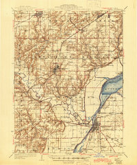
1925 Map of Havana
USGS Topo · Published 1945About this map
Havana and Lewistown anchor this Central Illinois landscape, which sits at the confluence of the Spoon River and the Illinois River during the mid-1940s. The map illustrates a transitional economy where agricultural townships like Isabel and Waterford meet the industrial coal operations of the Putman and Buckheart districts. Mining activity is prominent in the north, evidenced by the Cripple Creek Mine and Big Creek Mine, while the river lowlands are defined by extensive backwater features like Quiver Lake and Liverpool Lake.
Find a feature on this map
96 named features on this map. Tap any name to fly to it.
Don’t see what you’re looking for? This feature index may not catch every label — zoom into the map to look around manually.
Map Details
Editions of this 1925 Havana Map
3 editions found
Other maps of this area

1912 · Canton
USGS Topo · 1:62,500

1915 · Avon
USGS Topo · 1:62,500

1918 · Vermont
USGS Topo · 1:62,500

1921 · Vermont
USGS Topo · 1:62,500

1925 · Havana
USGS Topo · 1:62,500

1926 · Beardstown
USGS Topo · 1:62,500

1929 · Manito
USGS Topo · 1:62,500

1930 · Chandlerville
USGS Topo · 1:62,500

1930 · Glasford
USGS Topo · 1:62,500

1932 · Chandlerville
USGS Topo · 1:62,500