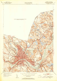
1952 Map of Haverhill
USGS Topo · Published 1953About this map
The Merrimack River serves as the industrial and geographic anchor for this mid-century survey of the Merrimack Valley. The urban core of Haverhill and the distinct community of Bradford across the water are shown in high detail, illustrating the density of postwar development alongside historic institutions like Bradford Junior College. The landscape is a mix of dense residential neighborhoods, many organized around the Boston and Maine RR corridors, and significant municipal infrastructure including the City Infirmary and the High School Stadium.
Find a feature on this map
78 named features on this map. Tap any name to fly to it.
Don’t see what you’re looking for? This feature index may not catch every label — zoom into the map to look around manually.
Map Details
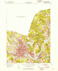
Editions of this 1952 Haverhill Map
2 editions found
Other maps of this area

1886 · Lawrence
USGS Topo · 1:62,500

1888 · Newburyport
USGS Topo · 1:62,500

1888 · Haverhill
USGS Topo · 1:62,500

1888 · Lawrence
USGS Topo · 1:62,500

1888 · Salem
USGS Topo · 1:62,500

1890 · Haverhill
USGS Topo · 1:62,500

1890 · Newburyport
USGS Topo · 1:62,500

1893 · Salem
USGS Topo · 1:62,500

1893 · Lawrence
USGS Topo · 1:62,500

1893 · Haverhill
USGS Topo · 1:62,500