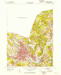
1952 Map of Haverhill
USGS Topo · Published 1953About this map
Merrimack River industry and community life define this mid-century survey of the Haverhill area. The dense urban center of Haverhill is shown in significant detail, featuring numerous educational institutions such as the Hannah Duston Sch, Tilton Sch, and the campus of Bradford Junior College south of the river. The map captures the city's growth along the Boston and Maine RR and its expansion toward outlying settlements like Rocks Village and Merrimac.
Find a feature on this map
75 named features on this map. Tap any name to fly to it.
Don’t see what you’re looking for? This feature index may not catch every label — zoom into the map to look around manually.
Map Details
Editions of this 1952 Haverhill Map
2 editions found
Other maps of this area

1886 · Lawrence
USGS Topo · 1:62,500

1888 · Newburyport
USGS Topo · 1:62,500

1888 · Haverhill
USGS Topo · 1:62,500

1888 · Lawrence
USGS Topo · 1:62,500

1888 · Salem
USGS Topo · 1:62,500

1890 · Haverhill
USGS Topo · 1:62,500

1890 · Newburyport
USGS Topo · 1:62,500

1893 · Salem
USGS Topo · 1:62,500

1893 · Lawrence
USGS Topo · 1:62,500

1893 · Haverhill
USGS Topo · 1:62,500