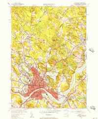
1955 Map of Haverhill
USGS Topo · Published 1957About this map
The Merrimack River serves as the focal point for this mid-century survey, dividing the industrial and residential core of Haverhill from the neighborhood of Bradford. The landscape is densely marked with civic and educational institutions, from Bradford Junior College to numerous neighborhood schools like Hannah Duston Sch and Smiley Sch. Transportation history is evident in the path of the Boston and Maine RR, which links settlements such as Newton Junction and Atkinson Depot.
Find a feature on this map
141 named features on this map. Tap any name to fly to it.
Don’t see what you’re looking for? This feature index may not catch every label — zoom into the map to look around manually.
Map Details
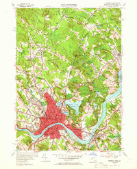
Editions of this 1955 Haverhill Map
2 editions found
Other maps of this area

1886 · Lawrence
USGS Topo · 1:62,500

1888 · Newburyport
USGS Topo · 1:62,500

1888 · Haverhill
USGS Topo · 1:62,500

1888 · Lawrence
USGS Topo · 1:62,500

1888 · Salem
USGS Topo · 1:62,500

1890 · Haverhill
USGS Topo · 1:62,500

1890 · Newburyport
USGS Topo · 1:62,500

1893 · Salem
USGS Topo · 1:62,500

1893 · Lawrence
USGS Topo · 1:62,500

1893 · Haverhill
USGS Topo · 1:62,500