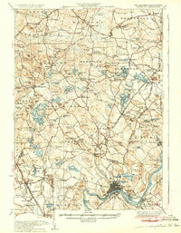
1935 Map of Haverhill
USGS Topo · Published 1935About this map
Rockingham Park and the industrial corridors of the Main Line of B & M R R define this landscape along the border of New Hampshire and Massachusetts. The 1930s terrain is characterized by a dense network of small villages and rural schoolhouses like South Road Sch and Pine Grove Sch, reflecting an era of localized community life before the full expansion of suburban development. Significant water bodies such as Island Pond, featuring Governors Island, and the Arlington Mill Reservoir highlight the region's reliance on both natural and man-made water resources for recreation and local industry.
Find a feature on this map
149 named features on this map. Tap any name to fly to it.
Don’t see what you’re looking for? This feature index may not catch every label — zoom into the map to look around manually.
Map Details
Editions of this 1935 Haverhill Map
5 editions found

Other maps of this area

1886 · Lawrence
USGS Topo · 1:62,500

1886 · Lowell
USGS Topo · 1:62,500

1888 · Newburyport
USGS Topo · 1:62,500

1888 · Haverhill
USGS Topo · 1:62,500

1888 · Lawrence
USGS Topo · 1:62,500

1888 · Salem
USGS Topo · 1:62,500

1890 · Haverhill
USGS Topo · 1:62,500

1890 · Newburyport
USGS Topo · 1:62,500

1893 · Lowell
USGS Topo · 1:62,500

1893 · Dover
USGS Topo · 1:62,500