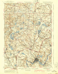
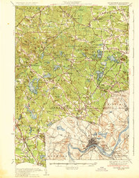
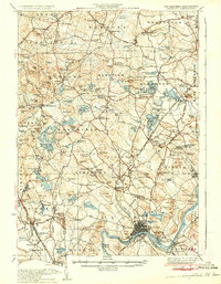
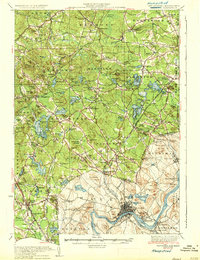
1935 Map of Hampstead
USGS Topo · Published 1940About this map
The Merrimack River valley serves as a bustling industrial and residential anchor for this mid-1930s landscape, with Haverhill and Bradford densely developed along its banks. Moving north into New Hampshire, the terrain transitions into a patchwork of hills, orchards, and small villages connected by the Boston and Maine Railroad. Significant water bodies like Canobie Lake, Island Pond, and the Arlington Mill Reservoir dot the countryside, illustrating the region's reliance on these basins for both industry and recreation.
Find a feature on this map
145 named features on this map. Tap any name to fly to it.
Don’t see what you’re looking for? This feature index may not catch every label — zoom into the map to look around manually.
Map Details
Editions of this 1935 Hampstead Map
5 editions found

Other maps of this area

1886 · Lawrence
USGS Topo · 1:62,500

1886 · Lowell
USGS Topo · 1:62,500

1888 · Newburyport
USGS Topo · 1:62,500

1888 · Haverhill
USGS Topo · 1:62,500

1888 · Lawrence
USGS Topo · 1:62,500

1888 · Salem
USGS Topo · 1:62,500

1890 · Haverhill
USGS Topo · 1:62,500

1890 · Newburyport
USGS Topo · 1:62,500

1893 · Lowell
USGS Topo · 1:62,500

1893 · Dover
USGS Topo · 1:62,500