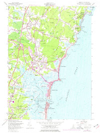
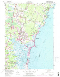
1957 Map of Hampton
USGS Topo · Published 1977About this map
The rocky Atlantic coastline and expansive salt marshes of Rockingham County define this mid-century survey of the New Hampshire shore. Centered on Hampton, the map captures the region's development as a premier coastal destination, from the seasonal density of Hampton Beach to the established neighborhoods at North Hampton Center and Rye Beach. The landscape transitions from the prominent glacial drumlin of Great Boars Head to the intricate network of the Hampton River and Tide Mill Creek, where expansive flats like Hampton Flats illustrate the complex drainage system of the seacoast.
Find a feature on this map
105 named features on this map. Tap any name to fly to it.
Don’t see what you’re looking for? This feature index may not catch every label — zoom into the map to look around manually.
Map Details
Editions of this 1957 Hampton Map
5 editions found
Other maps of this area

1888 · Newburyport
USGS Topo · 1:62,500

1890 · Newburyport
USGS Topo · 1:62,500

1893 · Dover
USGS Topo · 1:62,500

1893 · York
USGS Topo · 1:62,500

1894 · Newburyport
USGS Topo · 1:62,500

1916 · Dover
USGS Topo · 1:62,500

1918 · Dover
USGS Topo · 1:62,500

1920 · York
USGS Topo · 1:62,500

1932 · Newburyport
USGS Topo · 1:48,000

1934 · Exeter
USGS Topo · 1:62,500