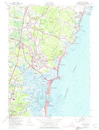
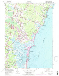
1957 Map of Hampton
USGS Topo · Published 1974About this map
The salt marshes and tidal estuaries of the Hampton River and Blackwater River dominate this coastal survey, revealing a landscape defined by its shifting interface with the Atlantic Ocean. During the mid-20th century, the region's character was shaped by established seaside communities like Hampton Beach and Rye Beach, alongside the intricate waterways of Hampton Harbor. The intricate network of tidal flats, including Hampton Flats and named islands such as Hunts Island and Beckmans Island, underscores the importance of maritime geography to local history. Inland, the map documents the transition from early education centers like Dearborn Academy and Marston Sch to modern infrastructure, including the Hampton Interchange and the Maine Turnpike. Notable landmarks such as St Francis College and the Hampton Airport provide specific points of interest for genealogists and local historians tracing the development of Rockingham County's shoreline.
Find a feature on this map
106 named features on this map. Tap any name to fly to it.
Don’t see what you’re looking for? This feature index may not catch every label — zoom into the map to look around manually.
Map Details
Editions of this 1957 Hampton Map
5 editions found
Other maps of this area

1888 · Newburyport
USGS Topo · 1:62,500

1890 · Newburyport
USGS Topo · 1:62,500

1893 · Dover
USGS Topo · 1:62,500

1893 · York
USGS Topo · 1:62,500

1894 · Newburyport
USGS Topo · 1:62,500

1916 · Dover
USGS Topo · 1:62,500

1918 · Dover
USGS Topo · 1:62,500

1920 · York
USGS Topo · 1:62,500

1932 · Newburyport
USGS Topo · 1:48,000

1934 · Exeter
USGS Topo · 1:62,500