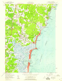
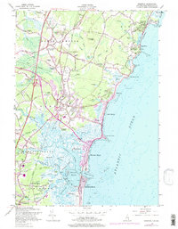
1957 Map of Hampton
USGS Topo · Published 1959About this map
The salt marshes and tidal estuaries of Hampton Harbor dominate this mid-century coastal survey, illustrating a landscape defined by the Hampton River and Blackwater River. The intricate network of tidal creeks, including Tide Mill Creek and Blind Cr, separates the developed beach fronts from the inland settlements. This era shows the early influence of the New Hampshire Turnpike and the Maine Turnpike on the region's accessibility, while the Boston and Maine RR continues to serve established communities like Seabrook Station and North Hampton Center.
Find a feature on this map
149 named features on this map. Tap any name to fly to it.
Don’t see what you’re looking for? This feature index may not catch every label — zoom into the map to look around manually.
Map Details
Editions of this 1957 Hampton Map
5 editions found
Other maps of this area

1888 · Newburyport
USGS Topo · 1:62,500

1890 · Newburyport
USGS Topo · 1:62,500

1893 · Dover
USGS Topo · 1:62,500

1893 · York
USGS Topo · 1:62,500

1894 · Newburyport
USGS Topo · 1:62,500

1916 · Dover
USGS Topo · 1:62,500

1918 · Dover
USGS Topo · 1:62,500

1920 · York
USGS Topo · 1:62,500

1932 · Newburyport
USGS Topo · 1:48,000

1934 · Exeter
USGS Topo · 1:62,500