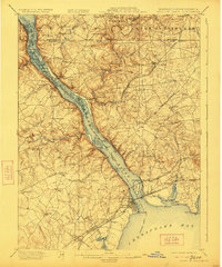
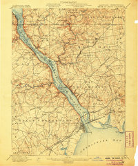
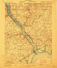
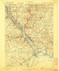
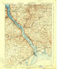
1900 Map of Havre De Grace
USGS Topo · Published 1923About this map
The Susquehanna River serves as the central artery for this late 19th-century landscape, carving a deep gorge through the hills of northern Maryland and southern Pennsylvania. Along its banks, industrial and transportation hubs like Port Deposit and Frenchtown anchor a network of railroads, including the Columbia and Port Deposit Branch. The map reveals a region defined by its water power and mineral resources, most notably at the Principio Furnace near the shores of the Northeast River. Away from the main river valley, the terrain transitions into a patchwork of rural crossroads and farming communities such as Rising Sun, Darlington, and Berkley. Genealogists may find value in the specific placement of family-named landmarks and rural infrastructure, from Lees Mill in the north to the isolated school at College Green. The map captures the intricate river-and-rail economy just before modern bridges and dams permanently altered the river's flow.
Find a feature on this map
112 named features on this map. Tap any name to fly to it.
Don’t see what you’re looking for? This feature index may not catch every label — zoom into the map to look around manually.
Map Details
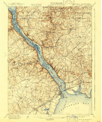
Editions of this 1900 Havre De Grace Map
7 editions found
Other maps of this area

1893 · Gunpowder
USGS Topo · 1:62,500

1898 · Elkton
USGS Topo · 1:62,500

1898 · Tolchester
USGS Topo · 1:125,000

1899 · Dover
USGS Topo · 1:125,000

1900 · Elkton
USGS Topo · 1:62,500

1900 · Cecilton
USGS Topo · 1:62,500

1900 · Havre De Grace
USGS Topo · 1:62,500

1900 · Betterton
USGS Topo · 1:62,500

1901 · Belair
USGS Topo · 1:62,500

1901 · Gunpowder
USGS Topo · 1:62,500