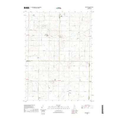
2018 Map of Hazelhurst
USGS Topo · Published 2018About this map
Elkhorn Creek and its many tributaries, including Eagle Cr and Goose Cr, carve a complex drainage pattern across this rural landscape at the intersection of four Illinois counties. The settlement of Hazelhurst serves as a central point in a region defined by agricultural history and a dense network of family and community burial grounds. Several historic river crossings are documented by name, such as Olin Bridge and Wolf Bridge, which provided essential connectivity across the winding creeks. The distribution of sites like the South Elkhorn Methodist Cem and the Penrose Friends Cem suggests a diverse religious heritage, from Methodists to Quaker communities, established along early roads like Genesee Rd and Pilgrim Rd. This survey illustrates the enduring rural structure of Ogle and Whiteside counties before modern consolidation altered many of these smaller crossroads communities.
Find a feature on this map
70 named features on this map. Tap any name to fly to it.
Don’t see what you’re looking for? This feature index may not catch every label — zoom into the map to look around manually.
Map Details
Editions of this 2018 Hazelhurst Map
This is the sole edition of this map. No revisions or reprints were ever made.
Other maps of this area

1930 · Woodsung
USGS Topo · 1:48,000

1934 · Morrison
USGS Topo · 1:48,000

1940 · Morrison
USGS Topo · 1:62,500

1942 · Mt Carroll
USGS Topo · 1:62,500

1942 · Forreston
USGS Topo · 1:62,500

1944 · Mt Carroll
USGS Topo · 1:62,500

1945 · Forreston
USGS Topo · 1:62,500

1946 · Sterling
USGS Topo · 1:62,500

1948 · Sterling
USGS Topo · 1:62,500

1954 · Rockford
USGS Topo · 1:250,000