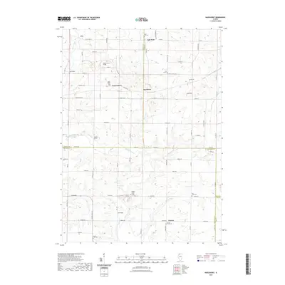
2021 Map of Hazelhurst
USGS Topo · Published 2021About this map
Eagle Point and Hazelhurst anchor this rural landscape where four Illinois counties—Carroll, Ogle, Whiteside, and Lee—meet. The terrain is defined by a dense network of streams including Elkhorn Creek, Goose Creek, and Jordan Creek, which are spanned by numerous named crossings such as Olin Bridge and Weidenhamer Bridge. This area is particularly significant for genealogists, as it contains an unusually high density of burial grounds relative to its small settlements. From the Brick Church Cemetery in the north to the Penrose Friends Cemetery and Maple Ridge Cemetery in the south, these sites provide a clear record of the families that established the farming communities of Hitt, South Elkhorn, and Penrose. The map also reveals the historical importance of the road network, with routes like Milledgeville Road and County Highway 7 connecting these dispersed agricultural hubs.
Find a feature on this map
70 named features on this map. Tap any name to fly to it.
Don’t see what you’re looking for? This feature index may not catch every label — zoom into the map to look around manually.
Map Details
Editions of this 2021 Hazelhurst Map
This is the sole edition of this map. No revisions or reprints were ever made.
Other maps of this area

1930 · Woodsung
USGS Topo · 1:48,000

1934 · Morrison
USGS Topo · 1:48,000

1940 · Morrison
USGS Topo · 1:62,500

1942 · Mt Carroll
USGS Topo · 1:62,500

1942 · Forreston
USGS Topo · 1:62,500

1944 · Mt Carroll
USGS Topo · 1:62,500

1945 · Forreston
USGS Topo · 1:62,500

1946 · Sterling
USGS Topo · 1:62,500

1948 · Sterling
USGS Topo · 1:62,500

1954 · Rockford
USGS Topo · 1:250,000