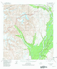
1949 Map of Healy A-6
USGS Topo · Published 1981About this map
Denali National Park and the rugged West Fork Chulitna River valley define this portion of the Matanuska-Susitna Borough. Based on 1949 photography with 1981 updates, the map documents a transitional period in Alaskan infrastructure where the Alaska Railroad and the Parks Highway run nearly parallel through the narrow corridor near Honolulu. This transport spine follows the low ground between towering peaks such as Vabm Joyce 6363 and Lookout Mtn.
Find a feature on this map
29 named features on this map. Tap any name to fly to it.
Don’t see what you’re looking for? This feature index may not catch every label — zoom into the map to look around manually.
Map Details
Editions of this 1949 Healy A-6 Map
5 editions found
Other maps of this area

1949 · Talkeetna Mountains D-6
USGS Topo · 1:63,360

1949 · Healy A-6
USGS Topo · 1:63,360

1950 · Talkeetna Mountains
USGS Topo · 1:250,000

1950 · Talkeetna
USGS Topo · 1:250,000

1950 · Talkeetna Mountains D-5
USGS Topo · 1:63,360

1950 · Healy A-5
USGS Topo · 1:63,360

1950 · Healy B-5
USGS Topo · 1:63,360

1951 · Talkeetna
USGS Topo · 1:250,000

1951 · Healy
USGS Topo · 1:250,000

1951 · Talkeetna Mountains D-5
USGS Topo · 1:63,360